Introduction:
Within this week's assignment, The geography 336 class at UW-Eau Claire was asked to survey the trees within a plot of land located on campus, using an Azimuth survey. Using this method, one person becomes a reference point, while a second person records the study objects relative location (in degrees) and distance from said reference point. This method is important to understand due to its versatile implications as a back up plan for surveyors, if original plans or equipment malfunction.
Study Area:
The area of interest, or study area was located on lower campus, along the Little Niagara Creek, right outside of Philips Hall. Figure 9.1 is a map referencing the general location of the area.
Methods:
As previously stated, to conduct this survey a minimum of two participants were needed. One person was used as a reference point, while other other person went to the objects being surveyed and recorded the location (in degrees) and distance from the reference point. Then attributing data was assigned to the objects of interest, which in this case was trees. In this instance, the attributing data included was the tree species and the trunk's diameter at chest level.
Once this was collected the data was normalized in an excel spreadsheet (figure 9.2) and then added into ArcMap by adding the XY data in order to create a point feature class. From here, the feature vertices to points tool was used to connect the surveyed locations (trees) to the reference point. From this data two maps were created to show the attributing data associated with the trees.
Results and Discussion:
Figure 9.3 is the final map showing the two attributing data types collected and the relative proximity to the first reference point. From the trees surveyed, 10 separate species were recorded, each with its associated trunk diameter. What is interesting about this data is that the trunk sizes, was always within close proximity to other trunks of the same species. To better visualize this, listed below are trees that were recorded more than once, with their associated diameters.
Conclusion:
Azimuth surveying is a easy method to accomplish within small locations. However can be very time consuming and harder to associate accuracy the larger the study area becomes. Yet using this method a better understanding of how other GPS survey equipment works and how data points are then collected.
Within this week's assignment, The geography 336 class at UW-Eau Claire was asked to survey the trees within a plot of land located on campus, using an Azimuth survey. Using this method, one person becomes a reference point, while a second person records the study objects relative location (in degrees) and distance from said reference point. This method is important to understand due to its versatile implications as a back up plan for surveyors, if original plans or equipment malfunction.
Study Area:
The area of interest, or study area was located on lower campus, along the Little Niagara Creek, right outside of Philips Hall. Figure 9.1 is a map referencing the general location of the area.
 |
| Figure 9.1: General location of the study area for azimuth survey. |
As previously stated, to conduct this survey a minimum of two participants were needed. One person was used as a reference point, while other other person went to the objects being surveyed and recorded the location (in degrees) and distance from the reference point. Then attributing data was assigned to the objects of interest, which in this case was trees. In this instance, the attributing data included was the tree species and the trunk's diameter at chest level.
Once this was collected the data was normalized in an excel spreadsheet (figure 9.2) and then added into ArcMap by adding the XY data in order to create a point feature class. From here, the feature vertices to points tool was used to connect the surveyed locations (trees) to the reference point. From this data two maps were created to show the attributing data associated with the trees.
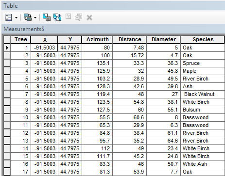 |
| Figure 9.2: Normalized data table that was added into ArcMap. |
Results and Discussion:
Figure 9.3 is the final map showing the two attributing data types collected and the relative proximity to the first reference point. From the trees surveyed, 10 separate species were recorded, each with its associated trunk diameter. What is interesting about this data is that the trunk sizes, was always within close proximity to other trunks of the same species. To better visualize this, listed below are trees that were recorded more than once, with their associated diameters.
- Oak:
- 7.7
- 5
- 4.7
- River Birch
- 64.6
- 61.1
- 49.5
- White Birch
- 24.8
- 23.4
- 38.1
 |
| Figure 9.3: On the left is associated tree species in reference to the reference point, and on the left is the same trees, but with their associated diameter in reference to the initial reference point. |
Conclusion:
Azimuth surveying is a easy method to accomplish within small locations. However can be very time consuming and harder to associate accuracy the larger the study area becomes. Yet using this method a better understanding of how other GPS survey equipment works and how data points are then collected.
Comments
Post a Comment